

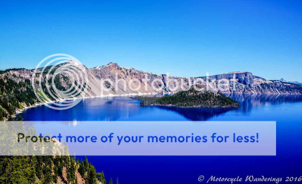
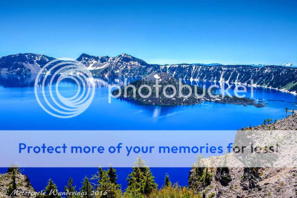
Adventure begins when one leaves their backyard. Northern California - even around the Shasta area is still my backyard. I consider Shasta home after all. Adventure can still be found here, if I had decided to go way off the beaten track, but I didn't this time around. The plan was to visit Crater Lake first - come in the South entrance, snap a few photographs and exit the north entrance, to find the Aufderheide scenic byway (for off the beaten track fun). Crater Lake was hardly busy at all, it was still early enough in the morning and not a lot of souls were stirring yet. Chilly as it almost always is, but still pleasant. Not a cloud in the sky, although I would have preferred some of those white fluffy ones to be floating around. The lake was mostly calm, and reflective in that deep, deep blue hue, echoing the thoughtful and introspective state of mind it instills.
You can spend an entire day here, multiple days - if you have the time, I ended up spending more time here than planned, despite not having the time scheduled in my route. I struck up a conversation with a couple riding from Minnesota to Napa, CA on their KLR650 motorcycles. They were the ones on a real adventure here, and they were having the time of their lives, and I lost track of time exchanging stories, and recommendations for routes, sights, and the really good places to eat! :)
It was time well spent, enjoying the ripples of someone-else's experiences and memories, run through the reflections of your own mind.
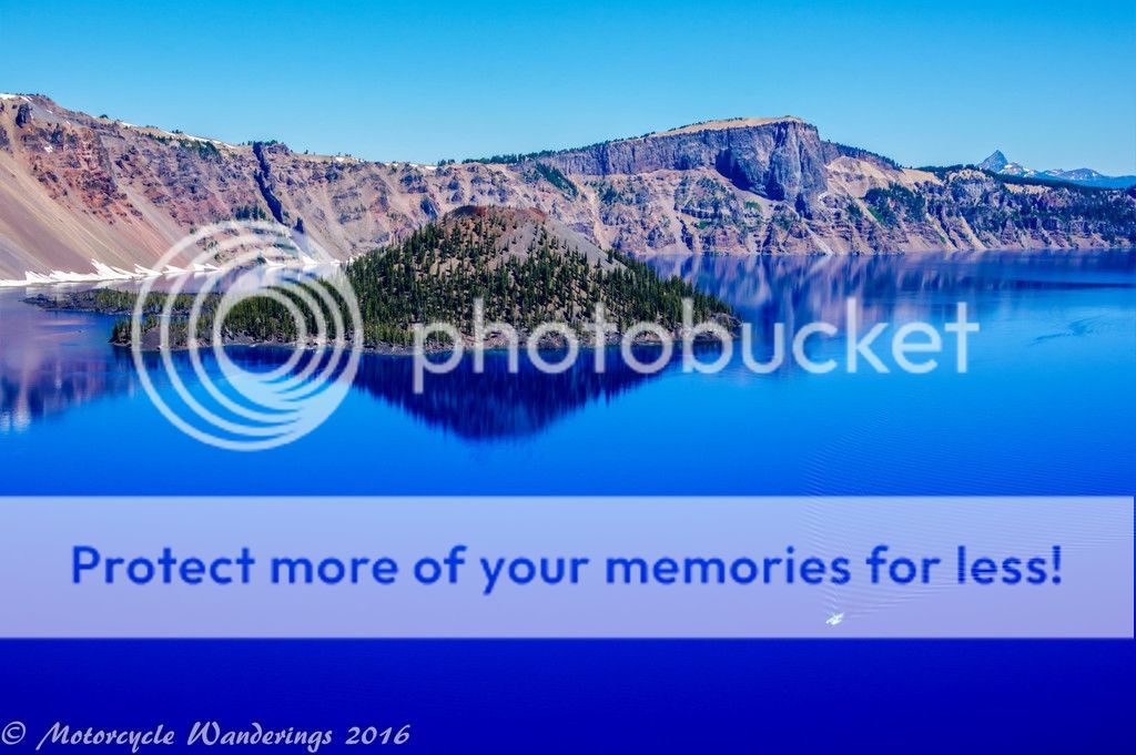
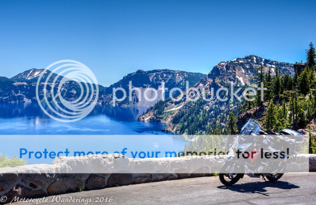
Back on the road, but way behind schedule. I bid adieu to my newfound friends, and continued on. I was running much later than I would have liked, but it is hard not to stop and admire this lake from multiple vistas. I know there are some who say that a circular lake looks the same from every vantage, to them I say take off those jaded blinders, and take a fresh look at your life. There is so much you are missing out on! :)
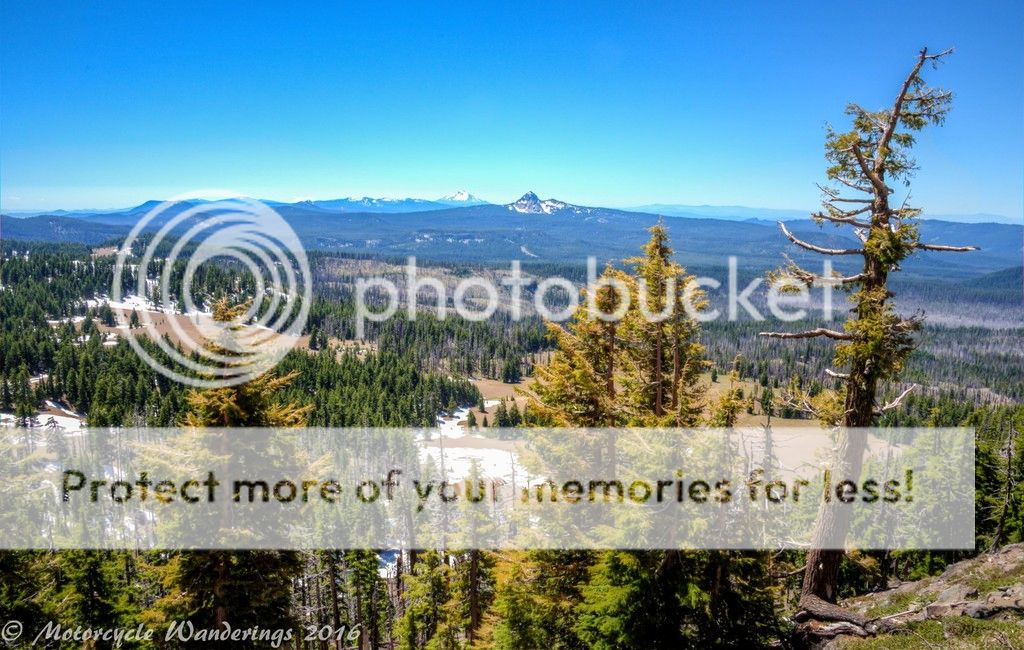
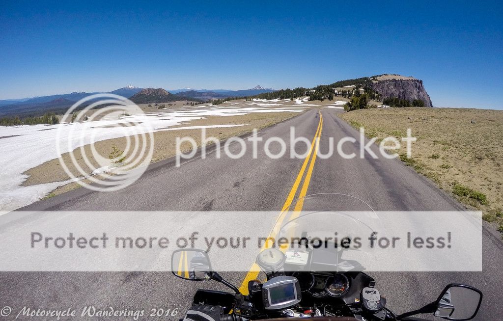
Mt. Mazama blew it's top approximately 7,700 years ago, before there was written history to record it anywhere in this world. Written history - or what has survived of it, as we know it only dates roughly 5,000 years ago. Although, on this continent, written history was very late in arriving - only a few centuries ago. Even now at ~6,000 feet, much diminished from it's past 12,000 foot glory, it still offers great vistas all around it.
Looking south. Union Peak, with Mt. Mcloughlin, I assume in the distance, although I am not entirely sure if it is.
... and Mt. Thielson - in the seemingly distance, but much closer in reality. The ultra-wide-angle of the GoPro skews the perspective - and pushes the perception of what's looming to seemingly three times the distance - much to my chagrin.
A parting shot. Look at that water - this lake is a liquified gem, something beautiful - created by something violently destructive, some gems are forever, and I hope so is the beauty of this place. Love it, protect it, share it with generations to come!
Exiting the park, I came down quickly from the giddy highs of being at Mazama, but I was heading for a gradual decline for this leg of the trip. Over the years I have had two Garmin waterproof GPS devices. The first one - which I still have and use is the venerable GPSMap 478. Still the best GPS Garmin ever made. It has been to hell and back, in storm cells and dust storms, and it has been rock-solid reliable on the FJR for over 85,000 miles. When I bought the V-Strom, I purchased a "refurbished by Garmin" Zumo 550 from a friend. I have been using it on the V-Strom for a couple years now, and it has been quirky from the get go. Quirky might be an understatement. It tells you to exit, then get right back on. Asks you to make turns, where no turns exist, unless you want to ride into a house, or a tree, or off a cliff. The worst of all so far had been that if you set a way-point way off your "main route", it gladly swallows it whole and pardon my french - shits it out, it even swallows up way-points for gas stops along the way, if they don't fall exactly on the way. "You don't need to go there - why do you need to go there? It's way off your route, you nitwit. Keep to the main route! I am just trying to help you out here.. oh and you don't need gas either, you can walk, can't you?"
I have been getting used to ignoring it's quirks and just paying more attention to it trying to "improve" my routing - by cutting out entire sections that it thinks are just not worth going to, but today it was going to up it's ante. Today was the day that the dreaded Zumo 550 stuck screen was going to strike. The GPS turned itself off on a gas stop in Oakridge, and wouldn't turn on, till I un-mounted it, removed the battery, and then assembled everything back together again. Even when I turned it back on - the screen was stuck, and I couldn't load the route for this leg. I wasted a lot of time using a folded paper to try and clean the edges so the screen would come unstuck - to no avail.
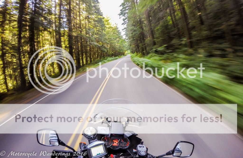
I had the route more or less memorized, perhaps a bit less, for the off the beaten track portion, and it became an issue trying to find my way to Aufderheide scenic byway from Hwy 58. I had never taken this route before, but I knew from some research, that I had to find a covered bridge somewhere here, which means I was on the right track. After some riding around, and U-turns I was able to find it, but then I encountered the very first road block. The road had been damaged in the Winter and there were 3 construction zones on this route - causing an additional combined delay of an hour and half. Detours were available, on side gravel roads, which is not an issue for the Strom, but without a functional GPS (or paper maps)? Hmm. Somewhere in the back of my mind warning signs were going off. Pushing on was sounding like a bad idea, I like adventure, but I don't like stupid, and I don't do stupid. I want to be a crusty old motorcyclist some day, and that doesn't happen if you do stupid things.
I decided to turn back and leave Aufderheide for some other day, backtracking all the way on Hwy 58 to the Cascade Lakes turn-off. I had fun on Hwy 58, no traffic, no LE today, and on the bright side I got to relive it going the other way as well. Cascade Lakes is another seldom traveled byway, although I hear that compared to Aufderheide, it is practically a thoroughfare. I have taken the Cascade Lakes byway several times before, I didn't need a GPS to navigate it, but then after one stop, it turns off and then on, and son of a bitch - it's working again! I took the opportunity to plug in the address of my hotel in Bend!
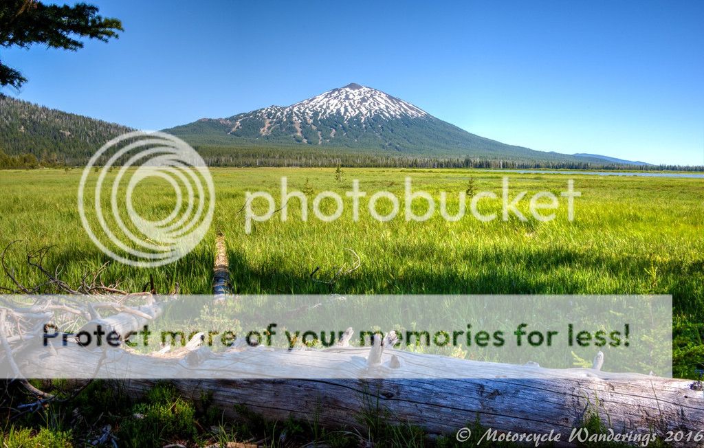
Cascade Lakes Hwy is smooth, and its fast fast fast! I was also looking forward to veering off here and there for short distances off the main by-way, and take the opportunity to explore some of the side roads which lead to said lakes.
Unfortunately, I no longer remember which lakes I visited, and which lakes I photographed. I did remember, for a couple days after the trip, but it's been more than 2 weeks since the trip now, and my mind is crammed full of work issues - the brain copes by forgetting the less important details. :(
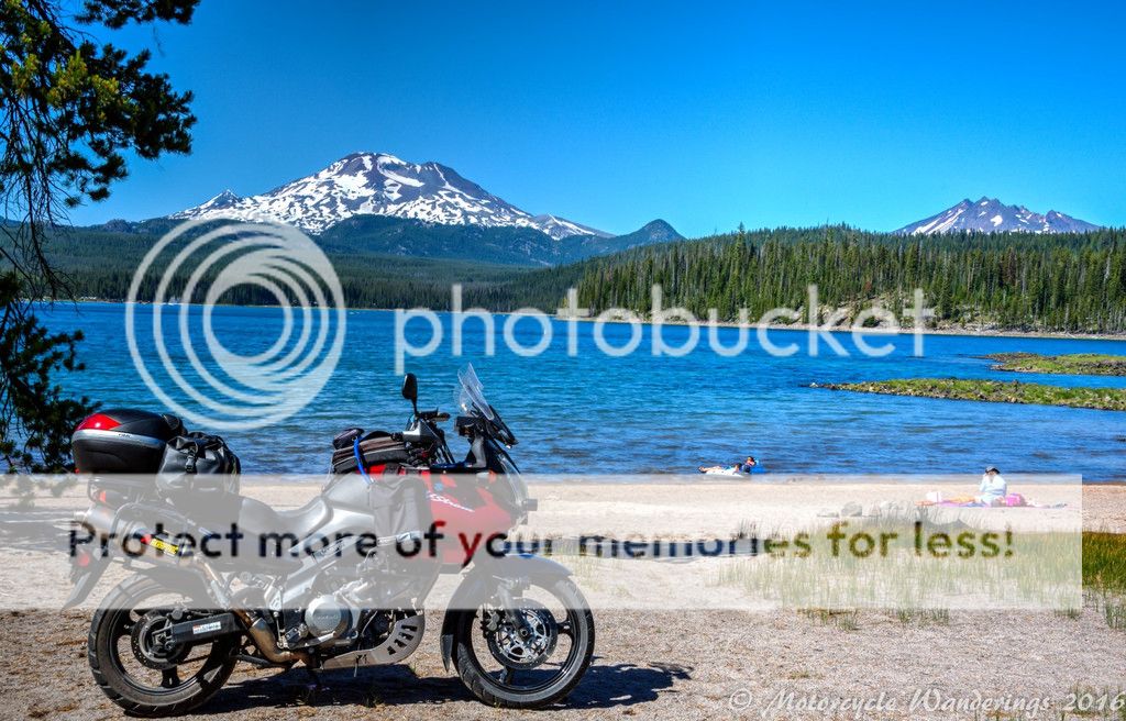
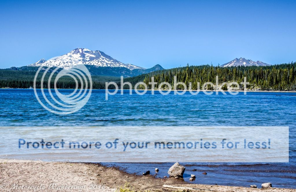
South Sister and Broken Top peering over the hillsides and trees at this lake I don't remember the name of... :-P
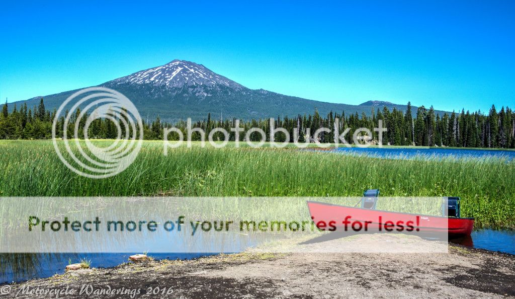
This one I think is Lava Lake, or Little Lava Lake, but don't quote me on it, I don't remember because I am getting 'old timer's'.
A Bachelor (Mt. Bachelor) and his toy!
A Bachelor with his more fun toys! Scantily clad women on that sail-boat would have completed the 'more fun' toys picture!
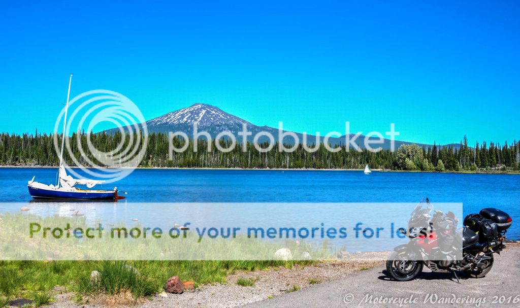
Mt. Bachelor is a very popular ski area. Easily accessible from Bend. You can see some of those ski runs on it's slopes. It's July and it's still wearing some powdery (maybe icy is more accurate) white on it's distinguished crown.
Bend was the stop for the night, and the Riverhouse on the Deschutes was the destination. Nice rooms, the nicest I have seen in Bend (to-date), and the bar/restaurant was upscale and packed with lot of pretty scenery. The bartender was a bit inattentive, I forgave him for that, the scenery was distracting him. The food was good, the drinks were strong, and I had a great table outside right along the Deschutes river. A very enjoyable way to unwind and rest after riding through the day, and to set myself up for a good night's sleep.
Morning came early, I was out the door at 6:30AM, quick gas-up and I was on my way back towards the mountains on Hwy 20, and then Hwy 22 towards Detroit. It was a beautiful morning, and a clear morning! I very much enjoyed seeing the Sisters mountains from the highway, and Mt Washington as well. It was also a cold morning. I had forgotten to zip up the jacket vents from the day before, and it was damn cold this morning at highway speeds. I had just passed several eighteen wheelers, and cars and trucks, and I would be damned if I was going to stop for anything for a while - even to zip up the jacket vents. I didn't want them to catch back up with me. I was just going to tuck behind the little windscreen and shiver it through, if I had to, to my first planned stop in the morning. It was cold, but not cold enough. I have rode through worse cold. I decided I would rather have a fun, clean run to Detroit, which I did! :)
I took a little coffee break in Detroit. I was going to go off the beaten track from here. The GPS - well, it had found a new lease on life, but I wasn't relying on it anymore. Even though, I have rode this route before, I used the WiFi at the Hotel to memorize my route, and put some notes in the map sleeve on top of my tank bag, along with an Oregon map I picked up at the gas station! Yay! :)
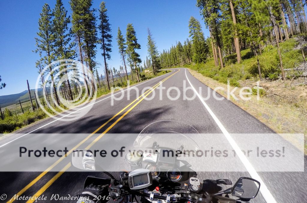
Breitenbush Rd. (NF-46) runs between Detroit, OR and Breitenbush, OR. Where every naked hippie wants to be - to soak in their natural hot springs. Not my cup of hot water, I was here for the fun road. It's not very scenic in any dramatic way, but it is a great ride. It will take you all the way to the suburbia of Portland, if you let it, but then that would just get weird(er)!
I branched off NF-46 on NF-42, it is a one lane road which meanders through the forests towards Oregon Skyline Road (two-lane), leading to Timothy lake and Mt. Hood. NF-42 is a lovely one-lane road, I have been through here before and I enjoyed it as much as, if not more than I did last time, and Skyline Road is smooth as silk and has some sweet corners!
In addition, this time I was on my own schedule and could stop to take this picture!
Hi Mt. Hood! Long time no see! :)
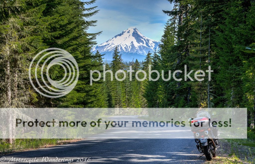
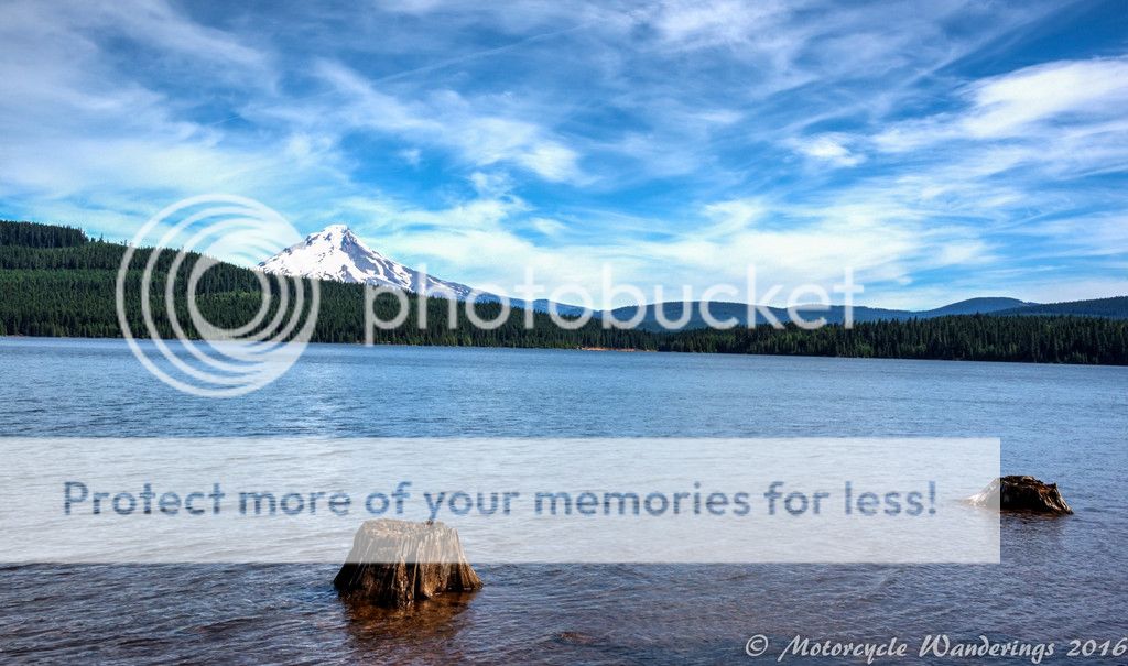
The useless GPS had eaten my Timothy Lake way-point out of the route for breakfast, as I suspected it would have. No matter, I found it for myself! I have been taking pictures of volcanoes by lakes or bodies of water (whenever I could, or when one was available), I wanted to keep the streak going!
I was planning on filling up at Government Camp. That town name always gives me a chuckle. Instead, I found a Chevron along the way before the turn-off for Mt. Hood Hwy (35). I took that opportunity to fill-up my tank and drain my bladder. As an LD rider friend has opined before - never give up a good gas and leak stop, and yeah - stay away from the Guvm't - it's up to no good!
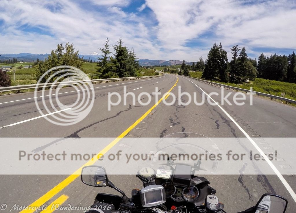
I was retracing my steps on Hwy 35, from 4 years ago, but this time, there were no cars or traffic on the highway. None. Zip.Zilch.Nada. This may also have been a good day to stop by Mt. Hood Meadows Ski Resort, and Umbrella or Sahalie Falls, but frankly, when I was routing I simply forgot, neither did I remember when I was actually riding through. Next time! :)
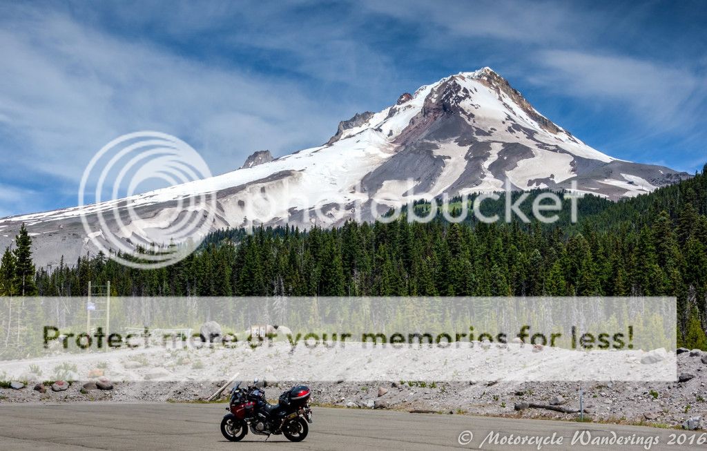
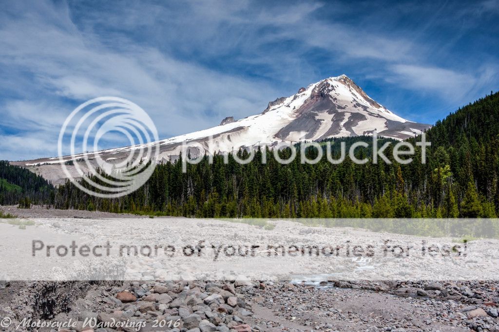
My itty bitty V-strom David and the Mt. Hood Goliath.
The much diminished White River is now and probably has been for a while - really just a burbling creek.
Ironically. I wasn't quite as impressed by Mt. Adams this time, as I was 4 years ago. You can see it in the distance in this skewed GoPro picture below. I was looking at it this time around, and was wondering what impressed me about it last time around, and couldn't remember the reason..
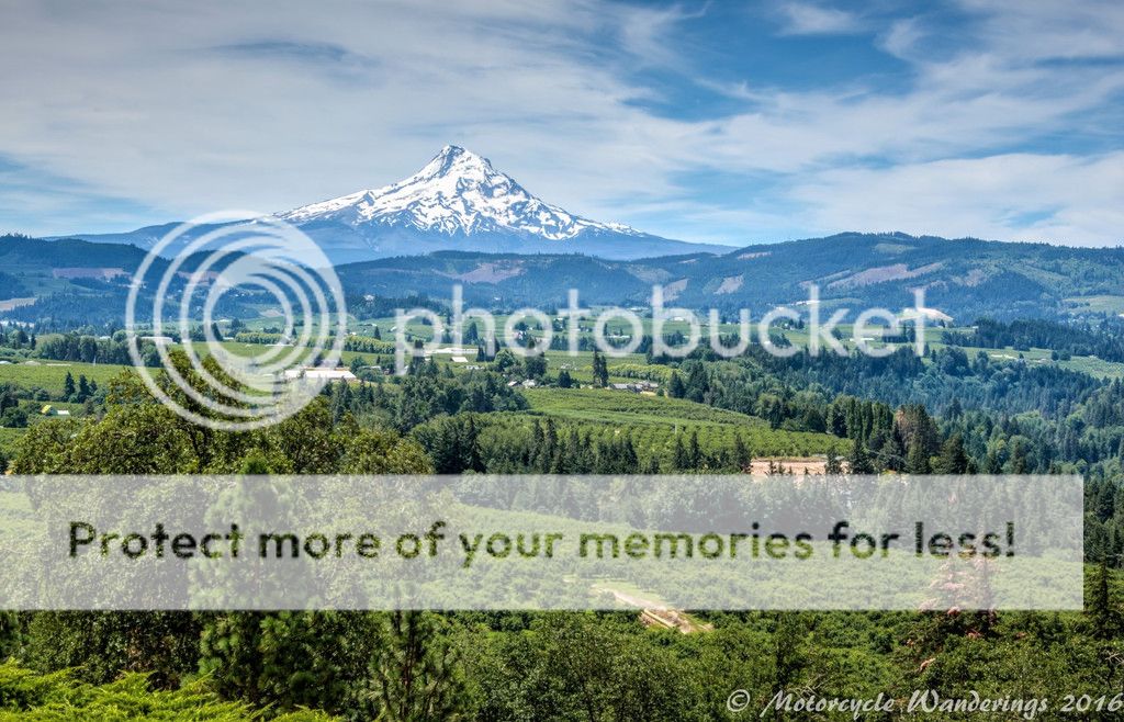
Mt. Hood had my attention and my affections this time around. The picture below is from Panorama point. I didn't know it existed, because I have been so busy at work - I didn't do the exhaustive research that I usually do before a trip. In all honesty, I half-assed it. It's all that I had the time for. Luckily, I noticed the sign from the highway - and decided to go check it out! I am very glad that I did! :D
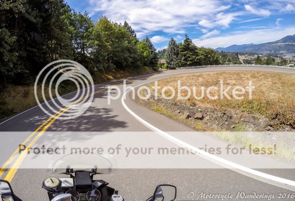
Leaving Panorama point, I got lost for a little bit, trying to descend into the town of Hood River - only exacerbated by a nutty GPS. Flip side of which was finding this sweet road I don't remember the name of...
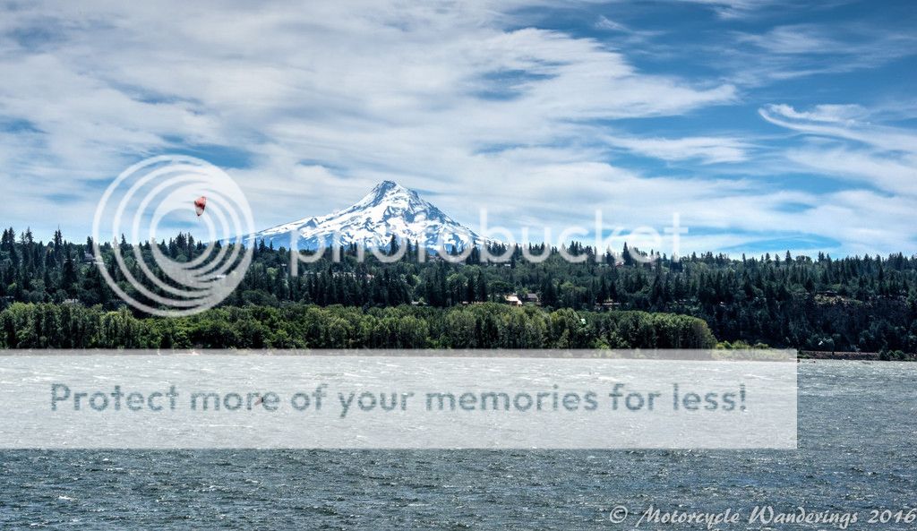
This was my backup "Mt. Hood and a body of water" picture opportunity. I had now crossed over the Columbia River into Washington, and as I picked up wind and sailed north - I said my farewell to Mt. Hood, and set my sights on other imposing volcanoes to come..
.. to be continued.
Thank you for reading! :)
Wow, once again, amazing stuff PC. Always look forward to these. Outstanding pics and prose. Good info on where you went and what you seen. I like where you "half assed" the planning, sometimes thats the best way. Thanks for taking the time and effort to share this!
ReplyDeletePerhaps, it's difficult for me not to plan well. Half-assed was due to lack of time and energy away from work. Although, that might just be the new norm. Thank you for your comments! :)
DeleteAin't it all just amazin'?
ReplyDeleteThanks for these inspirational pix and the narrative that goes along with. Continued safe travels...
It is an amazingly beautiful country we live in! Thank you for the well wishes, and returns the same sentiment on your journeys on the open road! :)
DeleteGreat ride report and picture. The narrative is great too!
ReplyDeleteThanks Jim! :)
DeleteNice to see you riding in our backyard. I laughed that you took the Cascade Lakes Highway. I don't think we've every been on it as we're always on the Aufderheide, lol.
ReplyDeleteBeautiful photos though......
Aufderheide has eluded me. Next time - that's where I will be making a bee-line for! :)
DeleteSorry Aufderheide eluded you again. I like riding it south to north, and stopping for refreshment at Takoda's. Harbick's Country Inn is a nice overnight spot, right across the road.
ReplyDeleteHi Ally!
DeleteAdmittedly my research on Aufderheide has been lousy. I should have just pressed on instead of backtracking. I will definitely take a note of overnight opportunities for the next trip up there. :)
Sam