

Get your money's worth. At least in pictures, all 39 of them! Fair Warning! ;)
July 7th, 2012.
The beginning of this chapter overlaps the penultimate chapter. I felt that the story flowed better, if I separated the two evenings of festivities at the cabin in Packwood from the riding adventures of the day in between. Brian and I took some time in the morning after we arrived at the cabin to go explore Rainier National Park. Tobie had given us some very helpful ride suggestions and points of interests the night before and laid out several options. We chose not to ride the longer routes and decided to forego riding some tempting roads in the vicinity, so we could spend more time visiting with friends who had rode in from all around North America.
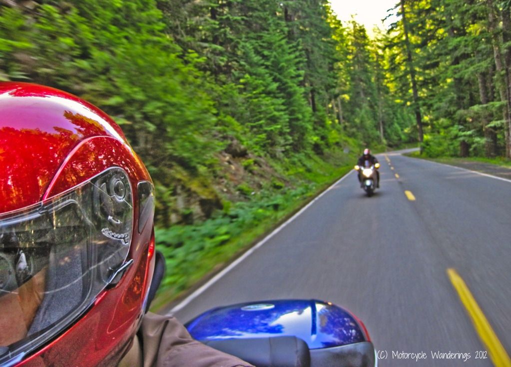
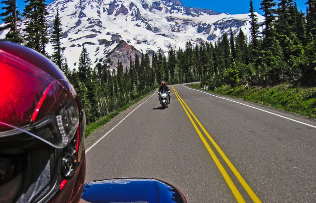
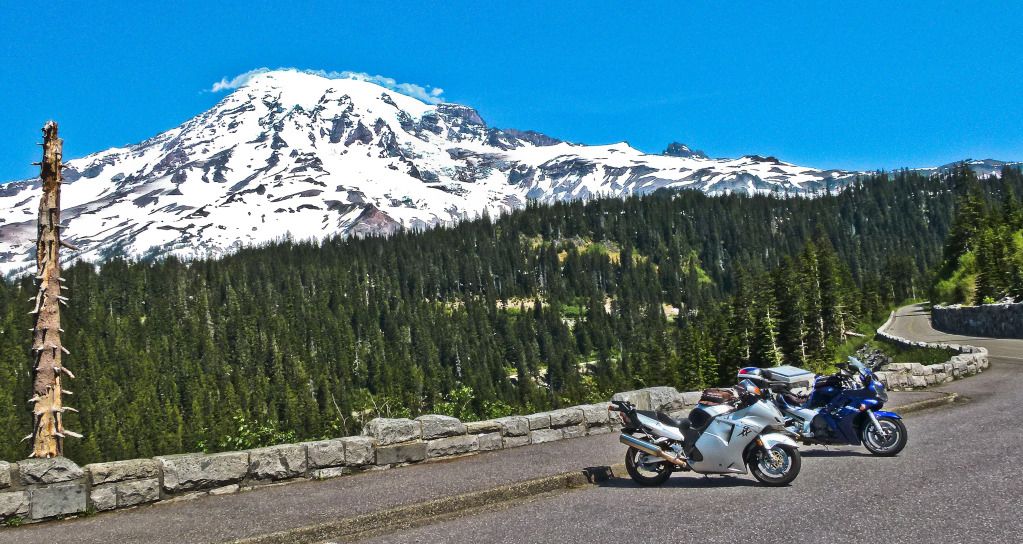
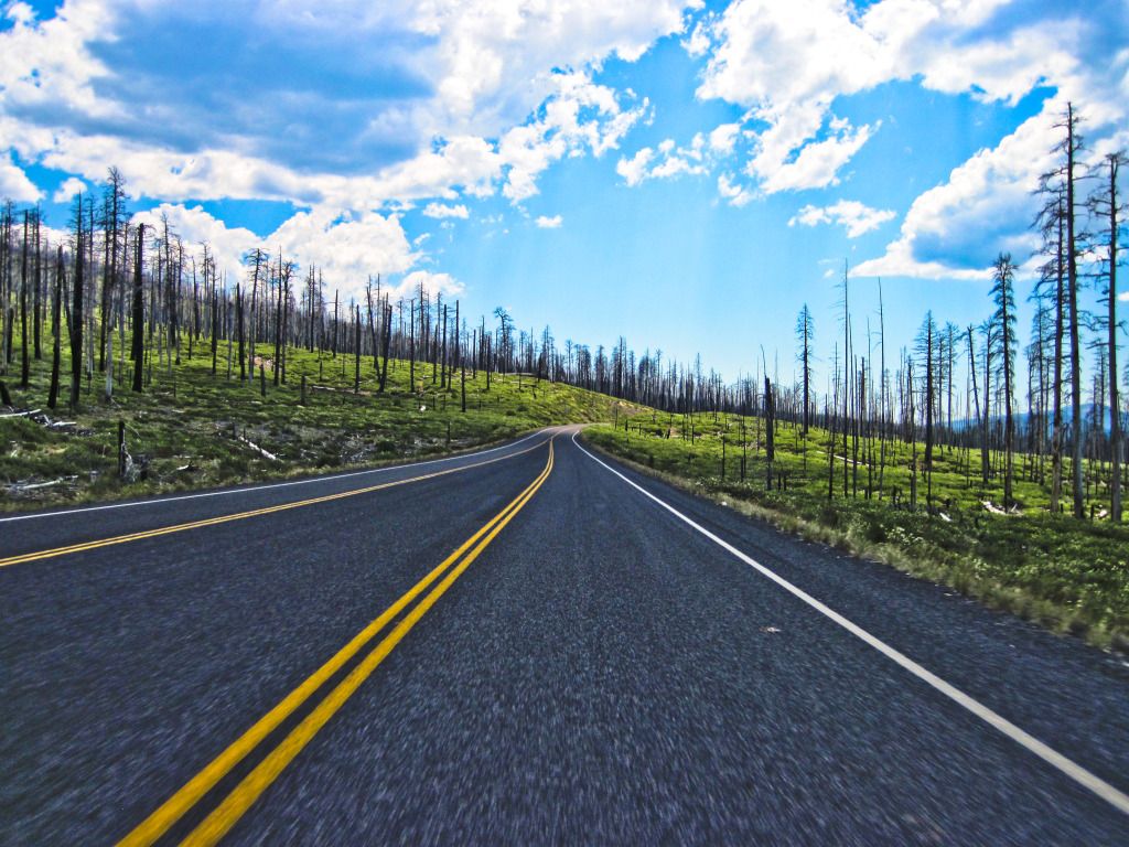
With an eye to a lunchtime return to the cabin, we got ourselves an early start and headed towards the East entrance of Rainier National Park and Stevens Canyon Road. The picture below is of Brian riding sweep on Stevens Canyon Road. Even though it was not a super early start, we found not many people were heading this direction.
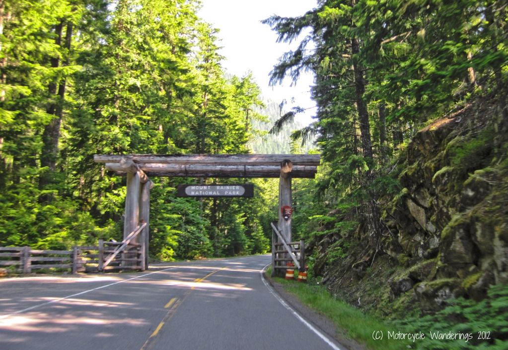
No long barbaric line at the gates. Actually no line at all, we were the only two at the entrance. Waltz right in and serenade the park rangers again to Brian's rendition of Lady Gaga. Although, this time I am not sure what he was singing. We were single file, I paid the park entrance fees for both of us and asked the rangers to hand the park map to the American Idol behind me.
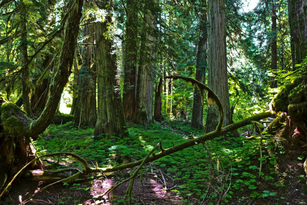
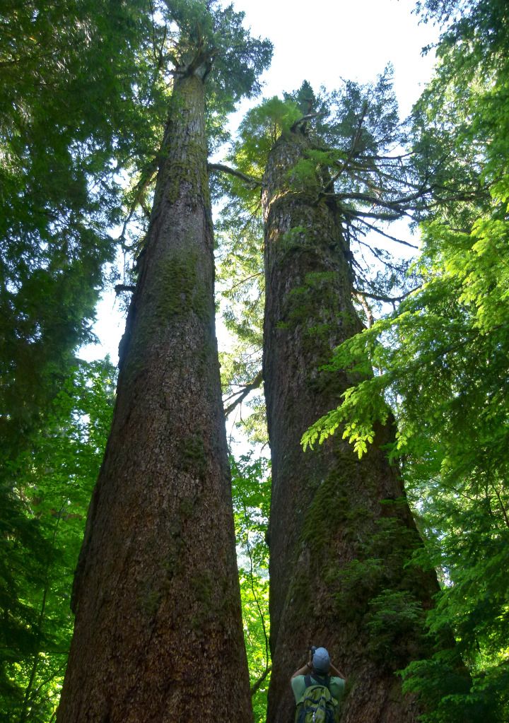
Although Mt. Rainier [14,410 ft] is clearly the main attraction in the park. On Tobie's suggestion we also stopped and took one of the easiest hikes in the park to the Grove of the Partriarchs. To quote Legolas from the Lord of the Rings.."This forest is old. Very old."
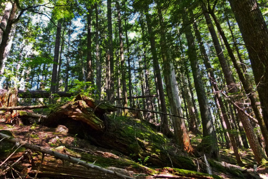
The trail is wide and an easy walk through some old and tall red cedars. Mushrooming new growth and old guards standing watch for the Patriarchs, mixed with felled ones slowly decaying,

The trails leads you upstream the Ohanapecosh River, leading you to a river crossing on a suspension bridge to the island of the Patriarchs. This is a single file bridge, meant to be crossed one person at a time. A good defensive strategy to throttle the approach to the Patriarchs.
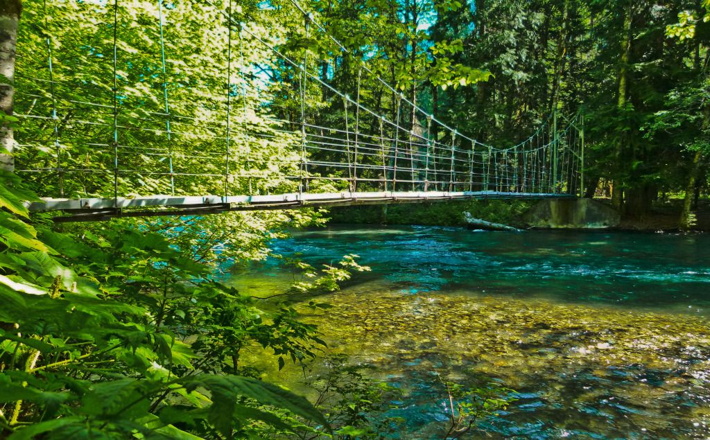
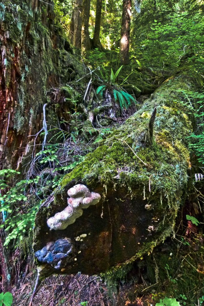
Upon this island, millennia of isolation and protection from fires by the Ohanapecosh River, has allowed these ancient groves of Western Cedars, Douglas Firs, and Western Hemlocks to grow to tremendous sizes and has allowed some to survive for over a 1000 years, and I believe continue to survive they will until the next time Rainier decides to pay them a visit.
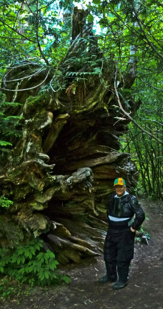
Pictures do not do the Patriarchs justice..
Keep a keen eye out for wildlife. Here, I spot a Warrior Bear, sporting Brazilian colors.
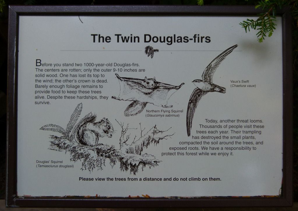
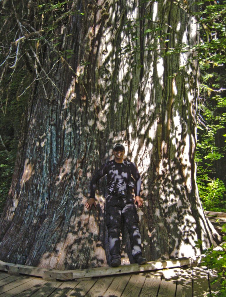
Two of the oldest of the Patriarchs. These inseparable brothers have stood by each other for about a 1000 years. Barely hanging on to life for possibly the past couple centuries...
"Brother I am dying....Nooooooooooo....!" A 100 years later "..ooooooooooo...". Another 100 years later "....oooooooooo..." and so on... ;)
All joking aside, these trees do inspire awe and respect, they have been standing long before we arrived on this continent, and probably will still be standing long after we are gone..
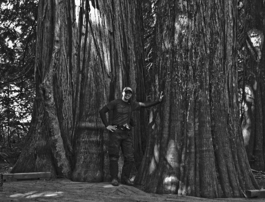
A couple more pictures from Brian, who did a much better job than I, showing you just how massive the circumferences of these trees really are.
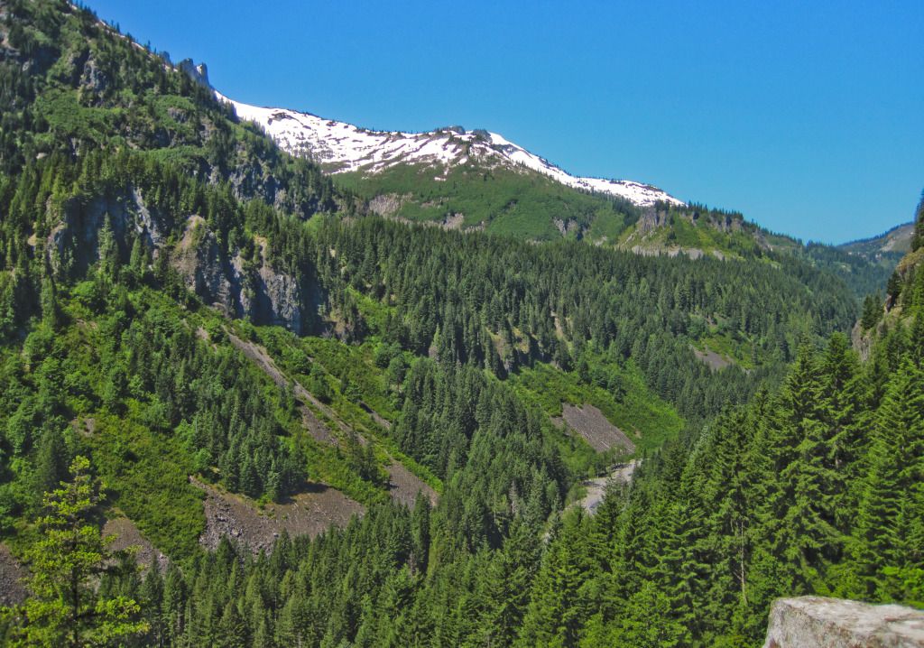
Leaving the Patriarchs, and continuing on Stevens Canyon towards Paradise Lodge, we were greeted by scenery which I hear rivals the Going to the Sun Highway. Hearsay for me at the moment, because I have yet to go to the sun myself.
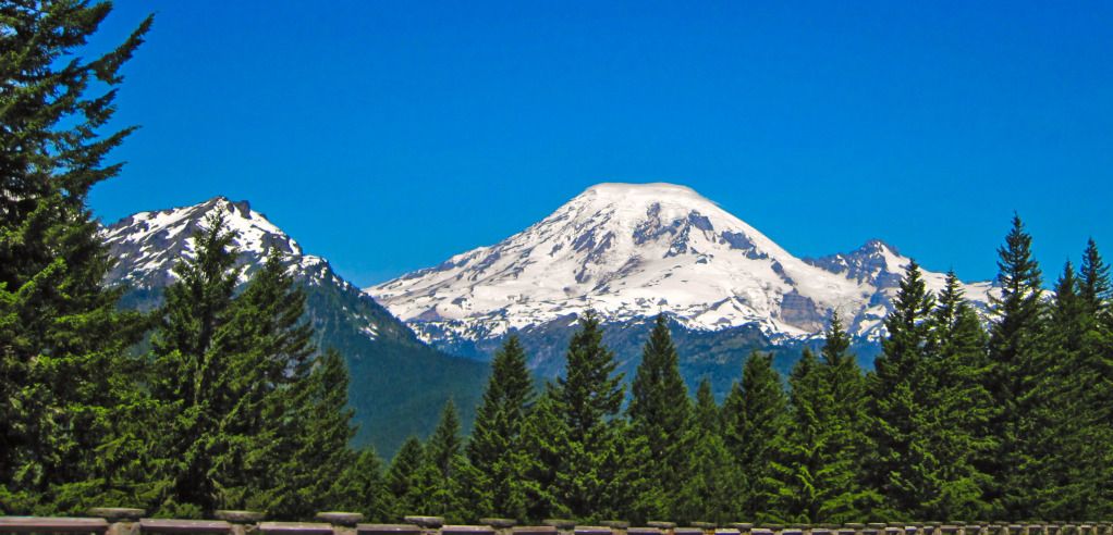
As Stevens Canyon twists it's way in between extensive mountains, you catch glimpses of Mt. Rainier towering over the tops of the tall trees lining the sides of the road. As luck would have it, I didn't have much luck photographing this as we rode along. On a bright sunny day such as this was, Mt. Rainier adorned in as many as 26 glaciers just overpowers the camera's sensor in full auto mode. Leaving just a washed out digital apparition in it's wake. Although, I wasn't entirely unlucky!
Glancing over the edges at the valleys and canyons below, the creeks appeared uncharacteristically dry at least from a distance. We passed a few waterfalls along the way, so all that water must be flowing somewhere..
When we did make stop for pictures, I tried to capture the transcending scale and majesty of Rainier, it seems however, that captivated by the ravaging aura of the mountain, I couldn't muster my photography mojo to stand it's ground. As a result, I believe I failed in my endeavor to acquire the essence of this mountain's commanding sway. My pictures mete Rainier a great injustice.. :(
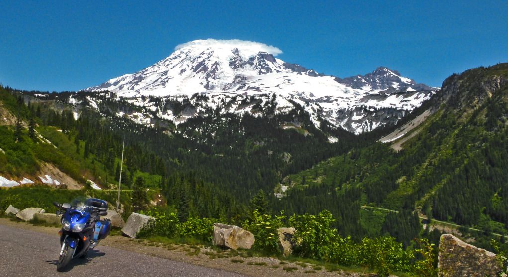
We Climbed towards the Paradise Lodge area and as we entered the parking area, we encountered the random absurdity which is the self righteous national park tourist. A snotty bicycle Nazi no less, did the best he possibly could to provoke Brian into beating the snot and the Nazi out of that emaciated carcass and then letting me kick it over the side of the cliff. Needless to say Paradise Lodge was a goat f**k, we abandoned our plans for an Ice Cream stop at the lodge and headed back down the mountain to continue on our way.
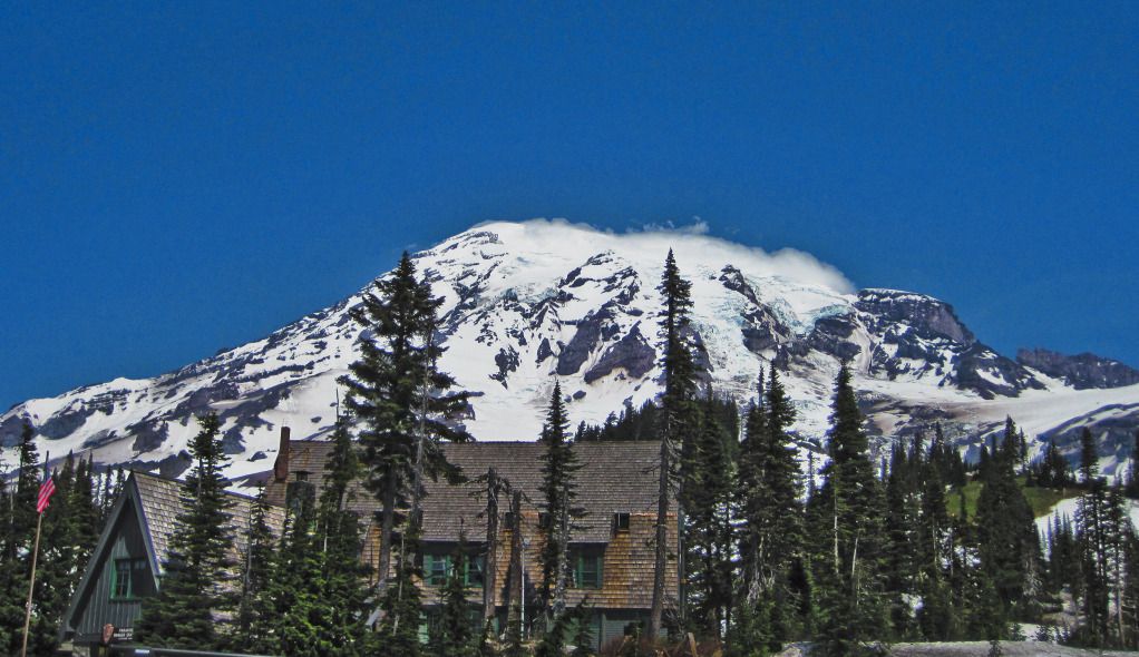
The view from Paradise Lodge.
One last look at Rainier, before we would round another curve and it will be in our rear view for the rest of the trip. Love looking at Mt. Shasta as much as I do, I think Shasta is a magical mountain, there is something about Shasta which is almost spiritual. Mt. Rainier on the other hand, once you get close enough, despite the halo that it likes to crown itself with, is just fearsome.
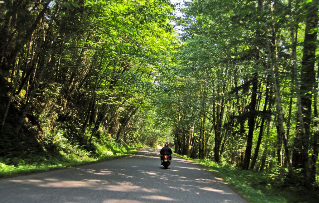
Riding out of the park, we took a shortcut back to Packwood, skating along on Skate Creek Road, as it skims beside Skate Creek. A nice road, can be a little patchy and bumpy at times, but compared to NF-25 north of Windy Ridge it is smooth as silk. All things considered, still very fun to ride.
Back in Packwood, I was vowing to return to Mt. Rainier for another round! Can hardly wait for the next Packwood RTE. Plan to stay multiple days in the area, and if Tobie is available, tag along behind him so as to continue my photography lessons!
July 8th, 2012.
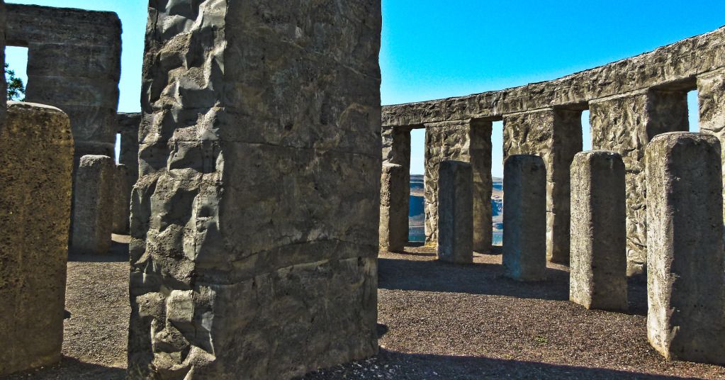
A day of riding long and riding hard. Corinne and her world famous Lasagna for dinner was waiting for us in Shasta, so we weren't spending too much time stopping to smell the roses. Once we started rolling from Packwood, we made no stops till we were almost to the Columbia River Gorge, where we stopped just north of the river banks above the town of Maryhill, to visit and pay our respects at the Stonehenge memorial.
This World War I memorial is a full-size replica Stonehenge, an almost exact copy of the English Stonehenge. Built my Sam Hill, a road builder, he first dedicated this in 1918, but it wasn't finished until 1930. Hill first initiated the project, thinking that the originial English Stonehenge was a sacrificial site. He supposedly embarked on this replica's construction to signify that "humanity is still being sacrificed to the gods of war".

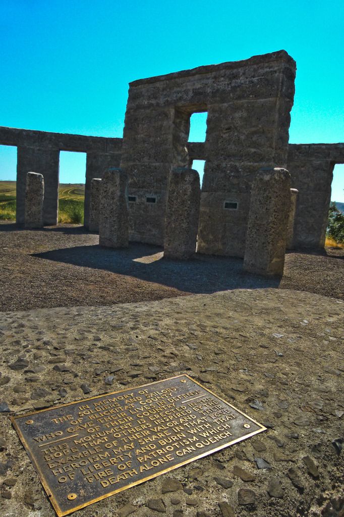
"In memory of the soldiers and sailors of Klickitat county, who gave their lives in defense of their country. This monument is erected in the hope that others inspired by the example of their valor and their heroism may share in that love of liberty and burn with that fire of patriotism which death alone can quench."
Amen.
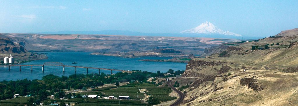
The view from the hill is amazing as well. My one and only picture of the Columbia River Gorge. You can see Miller Island, as well as a haunting Mt. Hood barely fading into view.
Back in Oregon, we headed towards The Dalles. I hadn't been too keen on following Hwy 97 it's entire length south through the state, so I talked Brian into detouring towards Hwy 197 and the savory and swift twists and turns that it serves up. The first picture taken just out of The Dalles.
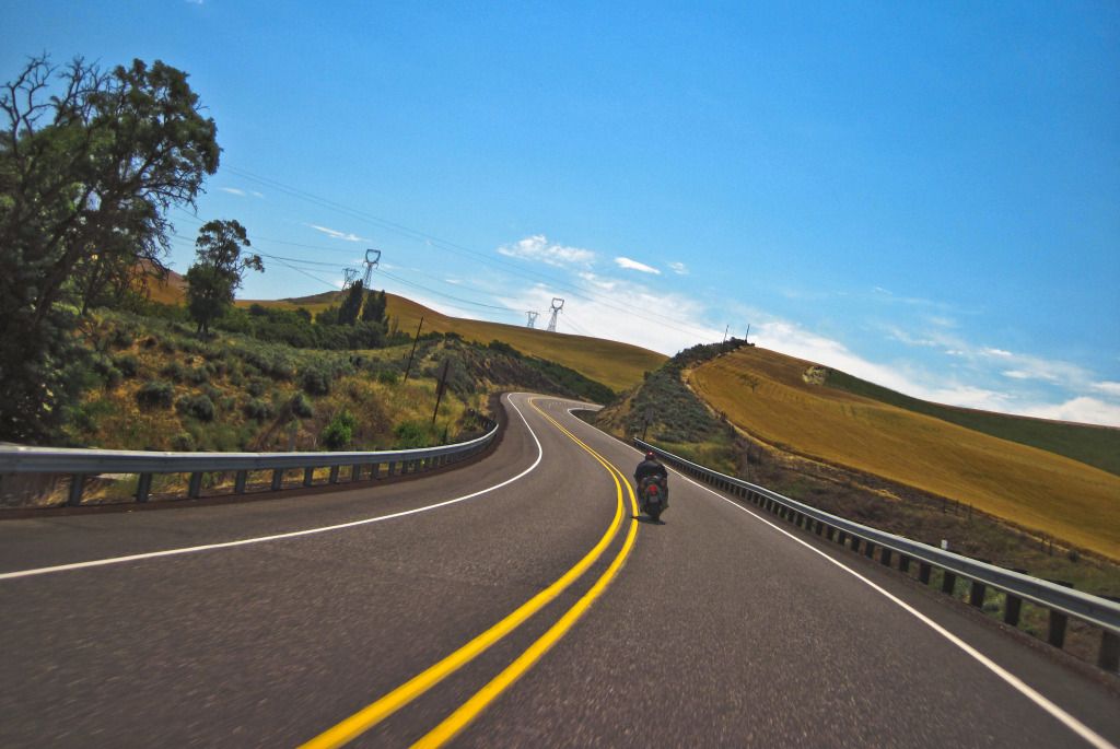
Coast through the town of Maupin, and then sprint through some more delightful turns, riding a motorcycle is indeed the closest you can get to flying, without ever leaving the ground! :)

No stops once again, not even for Gas, but yet again we departed from Hwy 97 to the scenic Cascade Lakes Scenic Byway. There are many lakes sprinkled through here, although from the road you can't really see them very well. The trees lining the sides of the roads are too tall and grow too thick for a good view anymore.
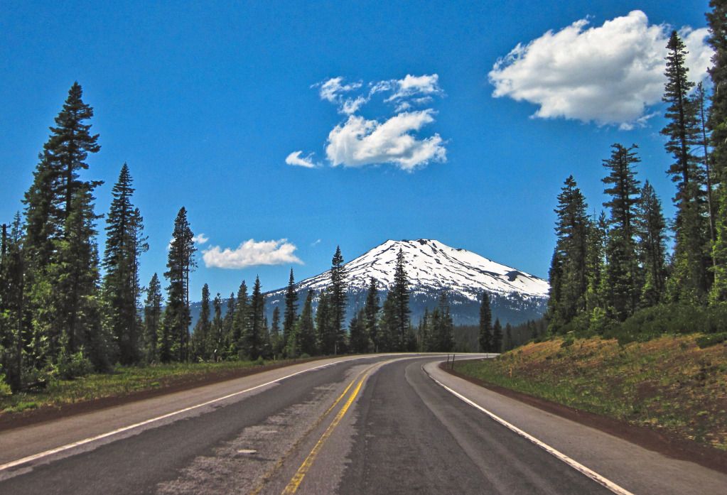
It does afford some good views of Mt. Bachelor [9,068 ft] and the three Sisters mountains to it's north. The highway runs right in between Mt. Bachelor and the Sisters. Why did the Bachelor cross the road? Gee, have you seen those Sisters? You wouldn't be asking me why, if you have!
Here is Mt. Bachelor as seen from the Cascade Lakes Hwy.
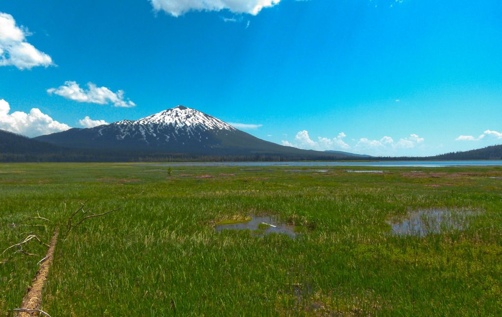
Unfortunately, the Sisters proved a little camera shy, so I don't have any good pictures to post of them, but here is another one of Mt. Bachelor and Sparks Lake.
Any cloud cover was very welcome! It was a hot day and we were feeling just a little scorched, not unlike the landscape we were currently running through, the seared and withered trees the remnants of a fire which had ripped through here in the recent past.

Finally, the long lost wanderers return to California. Stopping yet again to pay our respects at the second tallest flagpole in the United States. It was dedicated in June of 1996, to all of America's veterans. It is 200 ft tall and flies a flag 30 ft high and 60 ft long. This used to be the tallest flagpole in the U.S. until in 2002 the 308 ft flagpole in Laredo, TX surpassed it.

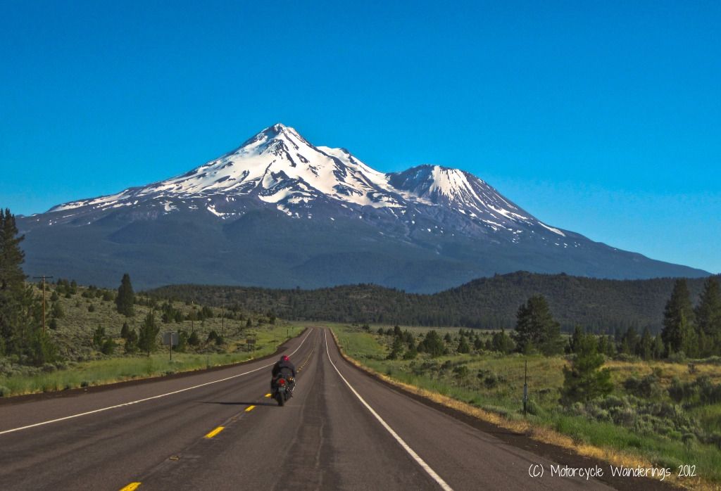
Within a whiff of our destination for the day. Quite a different view of Mt. Shasta. The peak of Shasta [14,179 ft] and the very prominently conical form of the peak of Shastina [12,330 ft]. Still my favorite mountain of the Cascades, rising abruptly almost 10,000 ft above it's surrounding terrain.
Mmmm and Corinne's Lasagna, still my favorite and the best I have ever had in my life! :)
July 9th, 2012.
The short trek home, Brian and I parted ways in Shasta, reunited with the tux wearing and 4 paw sporting little prince of Fernley, he was heading back to Nevada, and I was heading to Sacramento. My checklist for this trip, though, was still incomplete. I had skipped Mt. Lassen on my journey north, it was time to check it off the list.
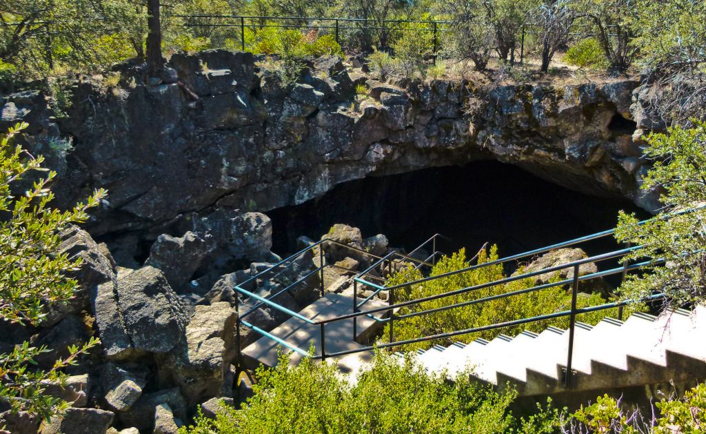
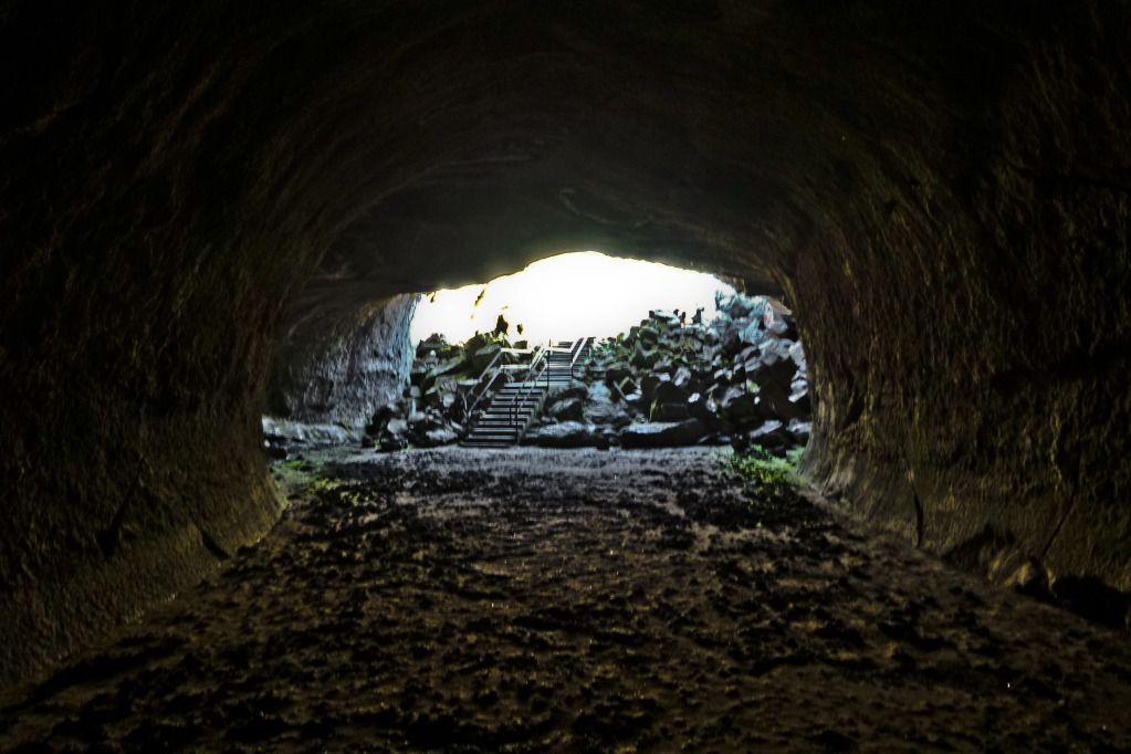
But first, I had been riding past these "subway cave" lava tubes for years and had never stopped. Today was going to be different. The Subway Cave Trail is a 1/3 mile trail, which leads you through an underground lava tube. The cave was originally discovered by the Atsugewi Indians, but as far as is known, they made no use of it. Their belief that the cave was inhabited by an evil creature, kept them out of the cave. A creature that they described as an "Ape Man". Ding ding ding.....Bigfoot anyone?
The entrance to the cave pictured below.
At the mouth of the lava tube, illuminated by the indirect sunlight from the entrance to the cave and the camera flash. Longer camera exposure also helped. ;)

A little ways in, the eerie darkness and silence broken up momentarily by the flash of the camera and it's shutter.
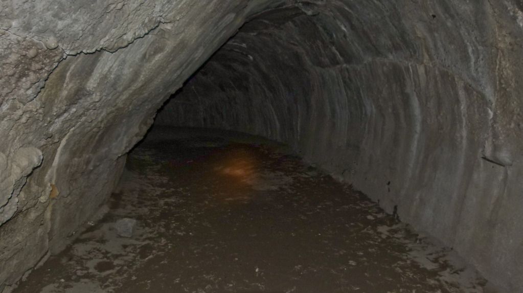
The Maglite flashlight I was carrying would prove to be pretty useless in the deep dark depths of this cave. It was pitch black except for a narrow and weak beam of light that the pocket Maglite was attempting to shine. I could see enough not to stumble and fall and the momentary flashes from the camera helped, but besides that I really couldn't see much else. A new 190 lumen LED pocket flashlight is currently on order. :)
Phew, found my way to the exit. I want to come back and walk through again, this time with a better flashlight!
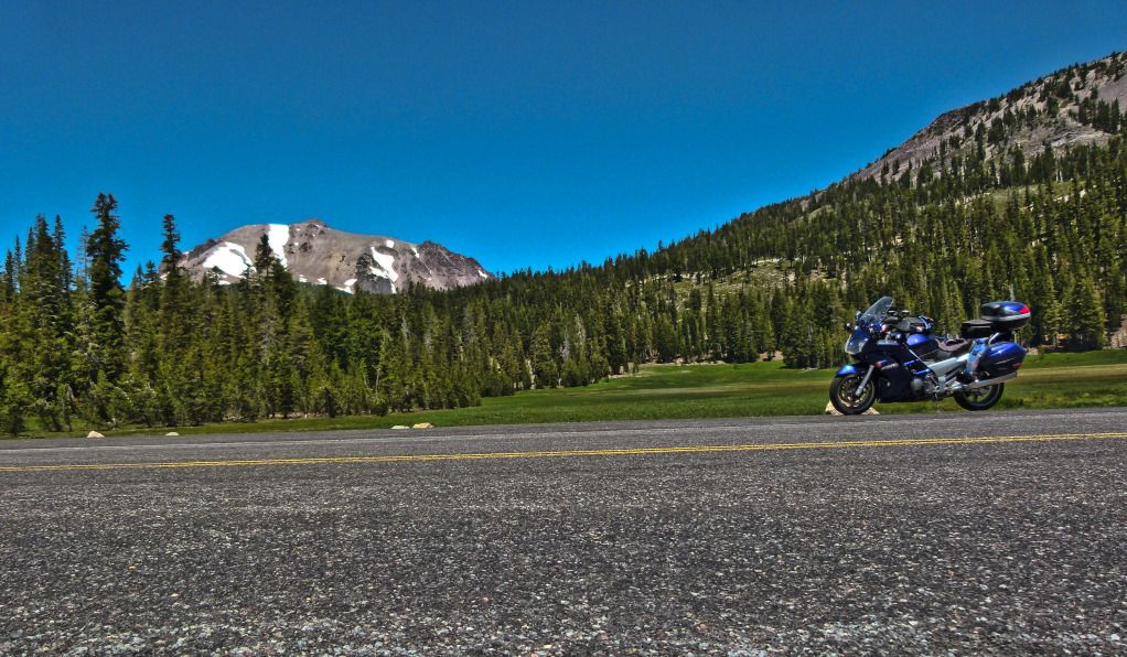
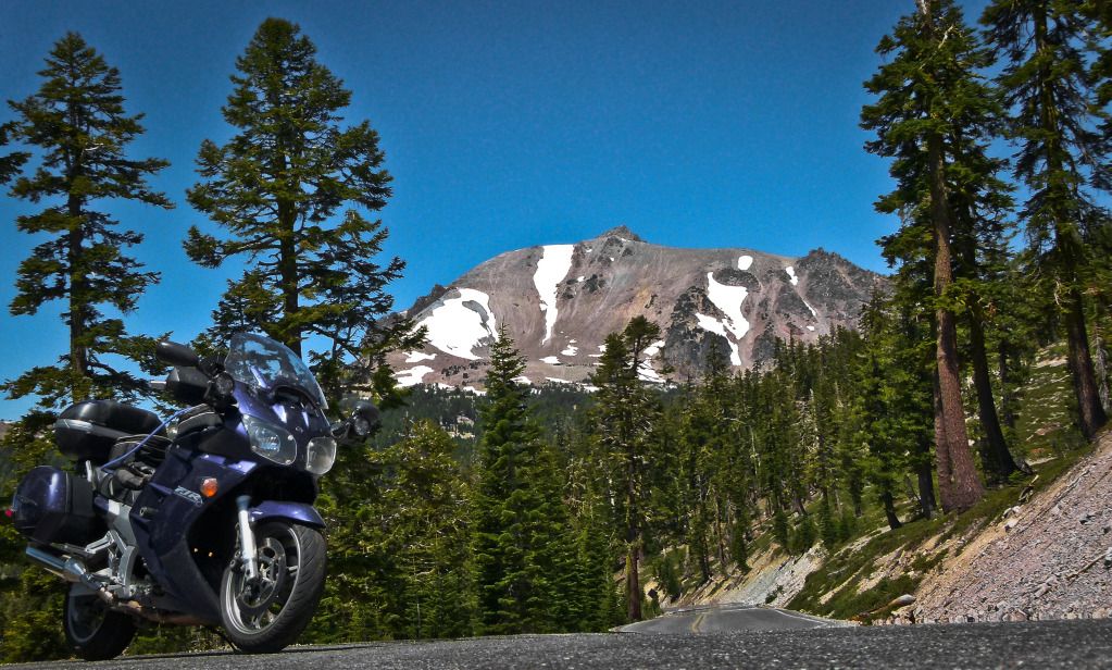
A quick run through Lassen National Park followed. Having ridden through here and having taken countless pictures, countless times before, I was a little lacking in inspiration to stop for pictures. Just a couple of shots, from a couple of stops, but still a lot of fun riding through some great scenery, enjoying an almost empty park.
Kings Creek and Upper Meadows area. Mt. Lassen [10,463 ft] in the background.
Just before Bumpass Hell area. Didn't stop at Bumpass Hell, some other time. :)
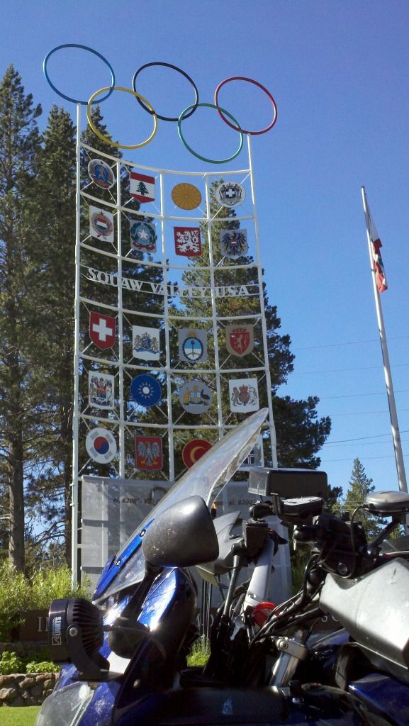
A quick detour to bag the then current Iron Butt Photo Tag. "The site of a past Olympic Games". This one being the site of the 1960 Winter Olympics in Squaw Valley. Cellphone picture. Shot and tagged/uploaded on the spot...
...and then... Home, sweet home! We certainly got our money's worth of fun and scenic riding, some of the best fun I have had all summer long. Hope you got your money's worth reading about our adventures as well. I am getting paid for this ain't I? No? Hopefully in smiles!
Once home there was one last tribute to our nation's heroes. Good movie, I enjoyed it!

Thanks much for reading! :)
Come back any time. We have Ape Caves, too. On the other side of that dreaded road over Mt. St.Helens, near the town of Cougar.
ReplyDeleteThanks! :D I will definitely be back next year. Probably a little later in the year, so as to give the reflection lakes and the roads to thaw out and cleared for fun! Want to explore that area more. Mt Adams area also. Next year, the riding priorities are the PNW to see you guys and Montana to go see Bob and Sylvie.
ReplyDeleteEnjoyed all your images! Thanks!
ReplyDeleteThank you for your kind words. My pleasure! :)
Delete